
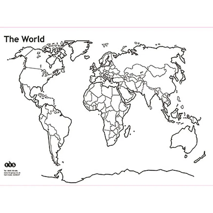
TTS World and British Isles Whiteboard Set of 5 A3
Original price was: £31.16.£21.96Current price is: £21.96.
Helping to Support Teaching and Learning
-
Versatile Learning Tool
-
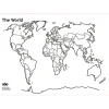
The reversible feature of these map boards, which showcase both the British Isles and the World, offers diverse teaching opportunities, from local geography to global exploration.
-
Durable and Lightweight
-
They constructed these map boards for durability yet made them lightweight for ease of handling, making them ideal for active learning environments and outdoor educational activities.
-
Supports Curriculum Goals
-
Aligned with Key Stage 1 and 2 geography curriculum, these maps aid in teaching geographical skills, locational knowledge, and fieldwork techniques effectively.
-
Practical Classroom Resource
-
A3 size ensures these maps are easily integrated into classroom activities, making them a practical choice for schools.
-
Geographical Skills Development
-
Facilitates the development of essential geographical skills at Key Stage 1, including the use of world maps, atlases, and understanding of basic human and physical features.
TTS World and British Isles Whiteboard Set A3
Durable, lightweight map boards designed for easy handling and practical learning.
Overview
-
Featuring reversible British Isles/World images with clear outlines for practical geography lessons.
-
Designed to engage children in geography, these A3 map boards are both durable and lightweight, making them perfect for varied educational settings, including outdoor learning. Their reversible design features the British Isles on one side and the World map on the other, facilitating diverse teaching scenarios.
-
Aligned with Key Stage 1 and 2 requirements, these boards enhance lessons on geographical skills, locational knowledge, and fieldwork. They help children identify key global landmarks, countries, continents, and oceans. Practical for teaching latitude, longitude, and other geographical concepts, they’re adaptable for limited classroom space, enabling hands-on learning.
-
Ideal for fostering curiosity about the world, these map boards are suitable for use in classrooms, during field trips, and in outdoor education, supporting active exploration and learning in geography. They serve as a valuable tool for introducing children to both local and global geographical features.
Supports the National Curriculum
Geography, Key Stage 1, Geographical Skills & Fieldwork
Use world maps, atlases and globes to identify the United Kingdom and its countries, as well as the countries, continents and oceans studied at this key stage.
Geography, Key Stage 1, Geographical Skills & Fieldwork
Use aerial photographs and plan perspectives to recognise landmarks and basic human and physical features, devise a simple map and use and construct basic symbols in a key.
Geography, Key Stage 2, Geographical Skills & Fieldwork
Use fieldwork to observe, measure record and present the human and physical features in the local area using a range of methods, including sketch maps, plans and graphs, and digital technologies.
Product Information
Overview
-
Suitable for age 5 years and up
-
5
Age Range
Pack Size
Sizes and Measurements
-
A3
Paper Size
Be the first to review “TTS World and British Isles Whiteboard Set of 5 A3”
Related products

Dens & Play Equipment


Art & Craft

Babies & Toddlers
Early Years

Early Years


Festivals & Celebrations

Art & Craft
Exercise Books
Early Years
Boxes & Containers

Festivals & Celebrations
Book Storage


Communication, Language & Literacy

Babies & Toddlers
Pe & Outdoor
Reviews
There are no reviews yet.