
TTS Teaching Atlas Upper Primary
£9.04
Helping to Support Teaching and Learning
-
Geographical Association
-
Developed in partnership with the Geographical Association, ensuring high-quality and accurate geographical content.
-
Curriculum Support
-
Fully supports the UK geography and history curriculums, making it a useful resource for integrated lesson planning.
-
Upper Primary Focus
-
Specifically designed for upper primary education, addressing the unique needs of key stage two learners.
-
Expert Contributions
-
Written by Ben Ballin and Alf Wilkinson, experts in geography and history education, ensuring reliable and engaging content.
-
Geographical Skills
-
Helps children use maps, atlases, globes, and digital/computer mapping to locate countries and describe features studied.
TTS Teaching Atlas Upper Primary
Designed to support UK geography and key history curricula.
Overview
-
Supports the development of key geographical and historical knowledge, encouraging critical investigation and understanding.
-
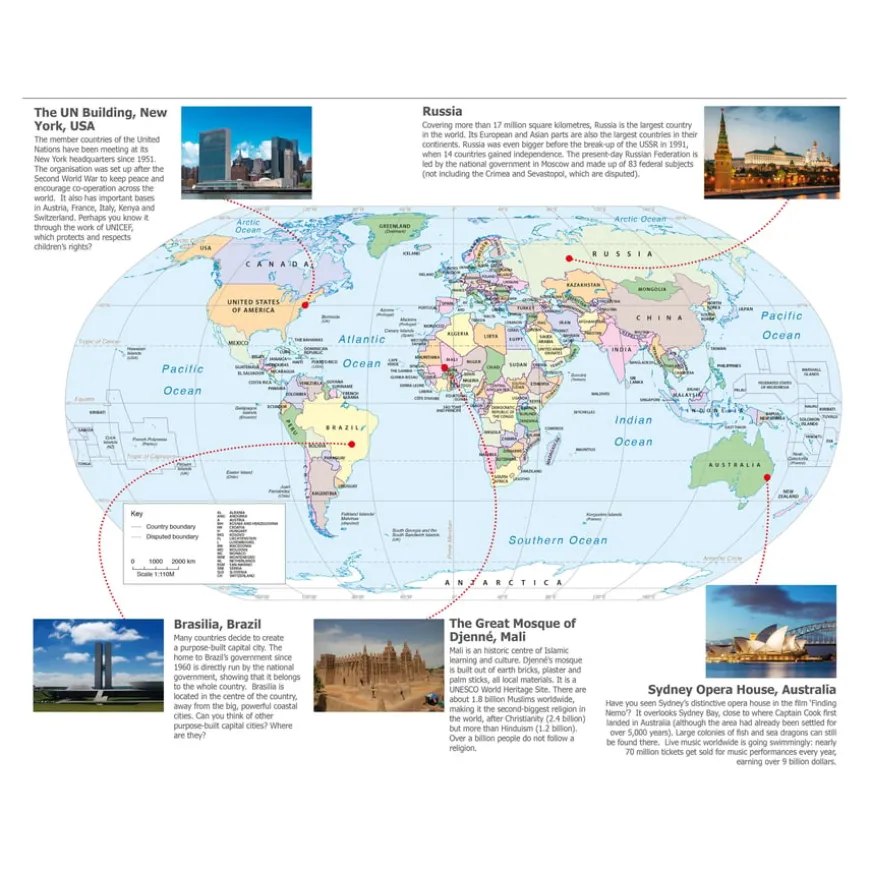
The Upper Primary Teaching Atlas helps children investigate topics through ‘Big Questions’, promoting the use of maps, debate, research, and data understanding. Written by Ben Ballin, a Geography Primary Consultant Specialist, the atlas comprehensively covers the geography curriculum. Alf Wilkinson, History CPD advisor, ensures the historical content is relevant.
-
The atlas supports Key Stage 2 geography, helping children use maps, globes, and digital mapping to locate countries and describe features. It focuses on Europe’s environmental regions, physical and human characteristics, and major cities. It also covers human and physical geography, including settlements, land use, economic activity, and natural resources.
-
For history, the atlas covers changes in Britain from the Stone Age to the Iron Age and extends pupils’ knowledge beyond 1066 with significant aspects of British history. It is a versatile resource for geography and history lessons.
Supports the National Curriculum
Geography, Key Stage 2, Geographical Skills & Fieldwork
Use maps, atlases, globes and digital/computer mapping to locate countries and describe features studied.
Geography, Key Stage 2, Locational Knowledge
Locate the world’s countries, using maps to focus on Europe concentrating on their environmental regions, key physical and human characteristics, countries, and major cities.
Geography, Key Stage 2, Human & Physical Geography
Describe and understand key aspects of physical geography and human geography, including types of settlement and land use, economic activity, and the distribution of natural resources.
Product Information
| Pack Size | 1, 15 |
|---|
Be the first to review “TTS Teaching Atlas Upper Primary”
Related products
Art, Craft & Design
Exercise Books

Art, Craft & Design


Art, Craft & Design

Art, Craft & Design


Art, Craft & Design
Classroom Chairs

Art, Craft & Design


Art, Craft & Design


Art & Craft
Art & Craft
Art, Craft & Design
Reviews
There are no reviews yet.