


The Oxford Primary International Atlas
£9.80
Helping to Support Teaching and Learning
-
Thematic Coverage
-
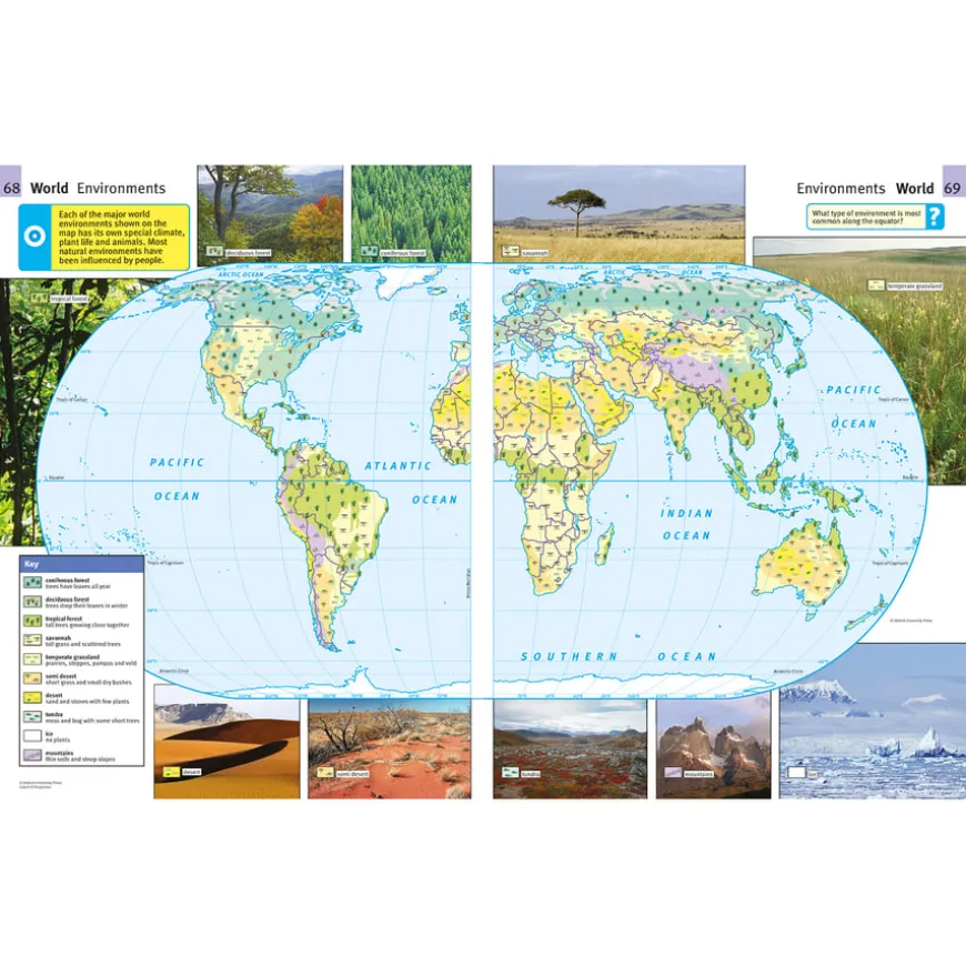
Offers excellent thematic coverage, thus clearly and comprehensively establishing itself as an atlas. Ideal for supporting a wide range of geographical topics.
-
Interactive Learning
-
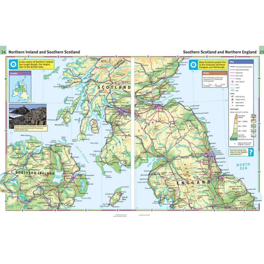
Features focus panels that encourage further enquiry, promoting interactive learning and deeper understanding of geography.
-
Child-Friendly Design
-
Designed with child-friendly grid codes, they ensure ease of use and accessibility for children exploring geographical concepts.
-
Colourful Mapping
-
Engages children with its colourful, clear mapping and aids in the visualisation of geographical information.
-
Curriculum Aligned
-
Supports skills in using maps and digital mapping to locate countries and describe features, aligning with Key Stage 2 Geography.
The Oxford Primary International Atlas
A comprehensive primary atlas with world topographic coverage.
Overview
-
Designed to support key curriculum themes including geography’s physical and human aspects, enhancing cross-curricular learning.
-
Designed for children aged 7 to 11 years, the atlas makes geography accessible and engaging. It highlights key curriculum themes such as physical and human geography, encouraging cross-curricular learning. Through accurate, colourful maps, it explores mountains, water cycles, and the interaction between humans and their environment.
-
Aligned with Key Stage 2 Geography, it teaches children to use various geographical tools to locate countries and describe their features. It facilitates an understanding of geographical similarities and differences by studying regions globally. Moreover, the atlas enhances locational knowledge, making concepts like latitude, longitude, and time zones understandable for children.
-
The atlas enhances interactive learning with child-friendly grid codes and focus panels, fostering enquiry into geographical topics. Its paperback format and engaging mapping make geography a delightful experience for young explorers.
Supports the National Curriculum
Geography, Key Stage 2, Geographical Skills & Fieldwork
Use maps, atlases, globes and digital/computer mapping to locate countries and describe features studied.
Geography, Key Stage 2, Place Knowledge
Understand geographical similarities and differences through the study of human and physical geography of a region of the United Kingdom, a region in a European country and North or South America.
Geography, Key Stage 2, Locational Knowledge
Identify the position and significance of latitude, longitude, Equator, Northern and Southern Hemisphere, Tropics of Cancer and Capricorn, Arctic, Antarctic Circle, Greenwich Meridian and time zones.
Product Information
| Pack Size | 1, 15, 6 |
|---|
Be the first to review “The Oxford Primary International Atlas”
Related products
Art, Craft & Design
Classroom Chairs
Art, Craft & Design
Art, Craft & Design

Art, Craft & Design
Art, Craft & Design
Art, Craft & Design
Art, Craft & Design
Art & Craft
Art, Craft & Design

Art, Craft & Design
Art, Craft & Design
Art, Craft & Design
Art, Craft & Design
Reviews
There are no reviews yet.