
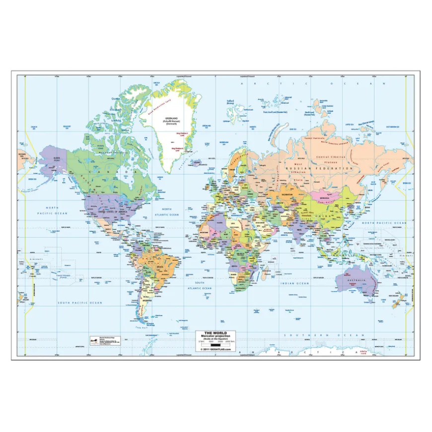
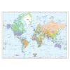
Mercator Map of the World Political A1
Original price was: £24.32.£18.92Current price is: £18.92.
Helping to Support Teaching and Learning
-
Detailed Projection
-
This map utilises a Mercator projection to show geographical and political layouts across the globe.
-
Educational Tool
-
Enhances geographical knowledge by highlighting countries and major cities, supporting curriculum standards.
-
Durable Design
-
Made from durable laminate, this map withstands frequent classroom use.
-
Interactive Learning
-
This map assists children in actively acquiring locational and mapping skills, such as using grids and compass points to explore the geographical distribution of world countries.
-
Curriculum Support
-
Enhances locational knowledge and geographical skills for Key Stage 2 Geography, using practical map skills.
Mercator Map of the World Political A1
A detailed Mercator projection map of the world, laminated for classroom durability.
Overview
-
Displays oceans, continents, countries, capitals, and political borders, suitable for various educational activities.
-
Enhance your teaching resources with this laminated Mercator projection map, suitable for use in classrooms. It serves as an essential tool for teaching locational knowledge and geographical skills in Key Stage 2.
-
This map supports the UK curriculum by enhancing geographical skills and fieldwork at Key Stage 2 level. It facilitates the teaching of how to use maps, atlases, and globes for locating countries and describing their features, including utilising compass points and grid references.
-
The durable laminate finish allows for hands-on interaction, supporting active learning and engagement in identifying environmental regions, key physical and human characteristics, and major cities.
Supports the National Curriculum
Geography, Key Stage 2, Locational Knowledge
Locate the world’s countries, using maps to focus on Europe concentrating on their environmental regions, key physical and human characteristics, countries, and major cities.
Geography, Key Stage 2, Geographical Skills & Fieldwork
Use maps, atlases, globes and digital/computer mapping to locate countries and describe features studied.
Geography, Key Stage 2, Geographical Skills & Fieldwork
Use the 8 points of a compass, 4- and 6-figure grid references, symbols and key (including the use of Ordnance Survey maps) to build their knowledge of the United Kingdom and the wider world.
Product Information
Overview
-
Suitable for age 7 years and up
-
Laminate
Age Range
Material
Sizes and Measurements
-
A1
Generic Size
Be the first to review “Mercator Map of the World Political A1”
Related products


Babies & Toddlers
Festivals & Celebrations


Pe & Outdoor

Babies & Toddlers
Festivals & Celebrations

Early Years
Early Years
Early Years


Babies & Toddlers
Early Years

Festivals & Celebrations
Exercise Books


Construction
Boxes & Containers
Festivals & Celebrations
Reviews
There are no reviews yet.